英文互译镜像站

Rural Municipality of Auvergne No. 76

Last updated

Auvergne No. 76
Rural Municipality of Auvergne No. 76
SK RM 76 Auvergne.svg
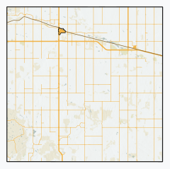
Location of the RM of Auvergne No. 76 in Saskatchewan
Coordinates: 49°39′40″N107°26′20″W / 49.661°N 107.439°W / 49.661; -107.439 [1]
Country Canada
Province Saskatchewan
Census division 3
SARM division 3
Federal riding Cypress Hills—Grasslands
Provincial riding Wood River
Formed [2] January 1, 1913
Government
[3]
   Reeve Richard Marleau
  Governing bodyRM of Auvergne No. 76 Council
  AdministratorSandra Krushelniski
  Office location Ponteix
Area
 (2016) [4]
  Land854.46 km2 (329.91 sq mi)
Population
 (2016) [4]
  Total
412
  Density0.5/km2 (1/sq mi)
Time zone CST
  Summer (DST) CST
Postal code
S0N 1Z0
Area codes 306 and 639

The Rural Municipality of Auvergne No. 76 (2016 population: 412) is a rural municipality (RM) in the Canadian province of Saskatchewan within Census Division No. 3 and SARM Division No. 3.

Contents

History

The RM of Auvergne No. 76 incorporated as a rural municipality on January 1, 1913. [2]

Heritage properties

There are four historical properties within the RM.

Demographics

Population history
(1981–2016)
YearPop.±%
1981550    
1986497−9.6%
1991447−10.1%
1996 430−3.8%
2001 355−17.4%
2006 329−7.3%
2011 354+7.6%
2016 412+16.4%
Source: Statistics Canada via Saskatchewan Bureau of Statistics [9] [10]

In the 2021 Census of Population conducted by Statistics Canada, the RM of Auvergne No. 76 had a population of 381 living in 105 of its 132 total private dwellings, a change of

In the 2016 Census of Population, the RM of Auvergne No. 76 recorded a population of 412 living in 118 of its 141 total private dwellings, a

Government

The RM of Auvergne No. 76 is governed by an elected municipal council and an appointed administrator that meets on the second Thursday of every month. [3] The reeve of the RM is Richard Marleau while its administrator is Sandra Krushelniski. [3] The RM's office is located in Ponteix. [3]

See also

References

  1. "Pre-packaged CSV files - CGN, Canada/Province/Territory (cgn_sk_csv_eng.zip)". Government of Canada. July 24, 2019. Retrieved May 23, 2020.
  2. 1 2 "Rural Municipality Incorporations (Alphabetical)". Saskatchewan Ministry of Municipal Affairs. Archived from the original on April 21, 2011. Retrieved May 9, 2020.
  3. 1 2 3 4 "Municipality Details: RM of Auvergne No. 76". Government of Saskatchewan. Retrieved May 21, 2020.
  4. 1 2 3 "Population and dwelling counts, for Canada, provinces and territories, and census subdivisions (municipalities), 2016 and 2011 censuses – 100% data (Saskatchewan)". Statistics Canada. February 8, 2017. Retrieved May 1, 2020.
  5. Napao Site
  6. Niska Site
  7. Pinto River School
  8. Tillet Hills
  9. "Saskatchewan Census Population" (PDF). Saskatchewan Bureau of Statistics. Archived from the original (PDF) on September 24, 2015. Retrieved May 9, 2020.
  10. "Saskatchewan Census Population". Saskatchewan Bureau of Statistics. Retrieved May 9, 2020.
  11. "Population and dwelling counts: Canada, provinces and territories, census divisions and census subdivisions (municipalities), Saskatchewan". Statistics Canada. February 9, 2022. Retrieved April 13, 2022.
MirrorElf MirrorElf 站点核心词加权 镜像站群系统 主动推送镜像站群