You can help expand this article with text translated from the corresponding article in French. (December 2008)Click [show] for important translation instructions.
|
Missy-aux-Bois | |
|---|---|
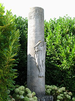 War memorial | |
 Location of Missy-aux-Bois | |
 Missy-aux-Bois  Missy-aux-Bois | |
| Coordinates: 49°20′15″N3°15′05″E / 49.3375°N 3.2514°E | |
| Country | France |
| Region | Hauts-de-France |
| Department | Aisne |
| Arrondissement | Soissons |
| Canton | Soissons-2 |
| Intercommunality | GrandSoissons Agglomération |
| Government | |
| • Mayor (2020–2026) | Gérard Couvreur [1] |
Area 1 | 3.04 km2 (1.17 sq mi) |
| Population (2023) [2] | 100 |
| • Density | 33/km2 (85/sq mi) |
| Time zone | UTC+01:00 (CET) |
| • Summer (DST) | UTC+02:00 (CEST) |
| INSEE/Postal code | 02485 /02200 |
| Elevation | 69–155 m (226–509 ft) (avg. 118 m or 387 ft) |
| 1 French Land Register data, which excludes lakes, ponds, glaciers > 1 km2 (0.386 sq mi or 247 acres) and river estuaries. | |
Missy-aux-Bois (French pronunciation: [misiobwa] ) is a commune in the Aisne department in Hauts-de-France in northern France.