英文互译镜像站

Gladfield, Queensland

Last updated

Gladfield
Queensland
Great Dividing Range seen from Gladfield, Queensland, 2023.jpg
Great Dividing Range as seen from Gladfield, 2023
Australia Queensland location map.svg
Red pog.svg
Gladfield
Coordinates 28°03′50″S152°10′44″E / 28.0638°S 152.1788°E / -28.0638; 152.1788 (Gladfield (centre of locality))
Population71 (2021 census) [1]
 • Density1.994/km2 (5.17/sq mi)
Postcode(s) 4370
Area35.6 km2 (13.7 sq mi)
Time zone AEST (UTC+10:00)
LGA(s) Southern Downs Region
State electorate(s) Southern Downs
Federal division(s) Maranoa
Suburbs around Gladfield:
Goomburra Goomburra Maryvale
Clintonvale Gladfield Maryvale
Freestone Upper Freestone Upper Freestone

Gladfield is a rural locality in the Southern Downs Region, Queensland, Australia. [2] In the 2021 census, Gladfield had a population of 71 people. [1]

Contents

History

Gladfield State School, 1908 Killarney District, Gladfield State School,1908.jpg
Gladfield State School, 1908

The locality name was derived from a pastoral run taken up in the 1840s, first by the Leslie brothers and later by Neil Ross who sold it in 1852, later becoming party of the Maryvale run. [2]

Gladfield Provisional School opened on 1 August 1887. On 1 January 1909, it became Gladfield State School. It closed on 1967. [3] It was at 13 Gladfield Back Road ( 28°04′36″S152°11′07″E / 28.07655°S 152.18528°E / -28.07655; 152.18528 (Gladfield State School (former)) ). [4] The school building was still extant on the site in October 2008. [5]

Demographics

In the 2016 census, Gladfield had a population of 57 people. [6]

In the 2021 census, Gladfield had a population of 71 people. [1]

Related Research Articles

<span class="mw-page-title-main">Pilton, Queensland</span> Town in Queensland, Australia

Pilton is a rural town and locality in the Toowoomba Region, Queensland, Australia. It is south of the city of Toowoomba. In the 2021 census, the locality of Pilton had a population of 71 people.

King Scrub is a rural locality in the City of Moreton Bay, Queensland, Australia. In the 2021 census, King Scrub had a population of 363 people. It is located on the northern outskirts of Dayboro.

McIlwraith is a rural locality in the Bundaberg Region, Queensland, Australia. In the 2021 census, McIlwraith had a population of 202 people.

<span class="mw-page-title-main">Motley, Queensland</span> Suburb of Toowoomba Region, Queensland, Australia

Motley is a rural locality in the Toowoomba Region, Queensland, Australia. In the 2021 census, Motley had a population of 10 people.

<span class="mw-page-title-main">Perseverance, Queensland</span> Suburb of Toowoomba Region, Queensland, Australia

Perseverance is a rural locality in the Toowoomba Region, Queensland, Australia. In the 2021 census, Perseverance had a population of 72 people.

<span class="mw-page-title-main">Whichello, Queensland</span> Suburb of Toowoomba Region, Queensland, Australia

Whichello is a rural locality in the Toowoomba Region, Queensland, Australia. In the 2021 census, Whichello had a population of 31 people.

<span class="mw-page-title-main">Mungar</span> Suburb of Fraser Coast Region, Queensland, Australia

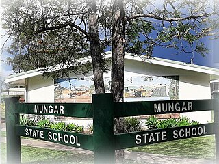
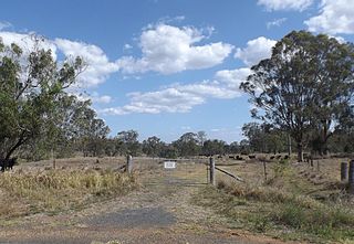
Mungar is a rural locality in the Fraser Coast Region, Queensland, Australia. In the 2021 census, Mungar had a population of 328 people.

Buaraba is a rural locality in the Somerset Region, Queensland, Australia. In the 2021 census, Buaraba had a population of 170 people.

Canaga is a rural locality in the Western Downs Region, Queensland, Australia. In the 2021 census, Canaga had a population of 85 people.

Canningvale is a rural locality in the Southern Downs Region, Queensland, Australia. In the 2021 census, Canningvale had a population of 118 people.

<span class="mw-page-title-main">Clintonvale, Queensland</span> Suburb of Southern Downs Region, Queensland, Australia

Clintonvale is a rural locality in the Southern Downs Region, Queensland, Australia. In the 2021 census, Clintonvale had a population of 72 people.

Moraby is a locality in the Western Downs Region, Queensland, Australia. In the 2021 census, Moraby had a population of 43 people.

Forest Springs is a rural locality in the Southern Downs Region, Queensland, Australia. In the 2021 census, Forest Springs had a population of 104 people.

Hookswood is a locality in the Western Downs Region, Queensland, Australia. In the 2021 census, Hookswood had a population of 58 people.

Inglestone is a locality in the Western Downs Region, Queensland, Australia. In the 2021 census, Inglestone had a population of 63 people.

<span class="mw-page-title-main">Coomrith, Queensland</span> Suburb of Western Downs Region, Queensland, Australia

Coomrith is a locality in the Western Downs Region, Queensland, Australia. In the 2021 census, Coomrith had a population of 52 people.

Pikes Creek is a rural locality in the Southern Downs Region, Queensland, Australia. In the 2021 census, Pikes Creek had a population of 19 people.

<span class="mw-page-title-main">Silverwood, Queensland</span> Suburb of Southern Downs Region, Queensland, Australia

Silverwood is a rural locality in the Southern Downs Region, Queensland, Australia. In the 2021 census, Silverwood had a population of 58 people.

Wiyarra is a rural locality in the Southern Downs Region, Queensland, Australia. In the 2021 census, Wiyarra had a population of 20 people.

Mount Sturt is a rural locality in the Southern Downs Region, Queensland, Australia. In the 2021 census, Mount Sturt had a population of 14 people.

References

  1. 1 2 3 Australian Bureau of Statistics (28 June 2022). "Gladfield (SAL)". 2021 Census QuickStats. Retrieved 28 February 2023. OOjs UI icon edit-ltr-progressive.svg
  2. 1 2 "Gladfield – locality in Southern Downs Region (entry 45932)". Queensland Place Names. Queensland Government . Retrieved 29 December 2020.
  3. Queensland Family History Society (2010), Queensland schools past and present (Version 1.01 ed.), Queensland Family History Society, ISBN   978-1-921171-26-0
  4. "Parish of Glengallan" (Map). Queensland Government. 1947. Retrieved 5 October 2023.
  5. Google (5 October 2023). "Gladfield State School (former)" (Map). Google Maps . Google. Retrieved 5 October 2023.
  6. Australian Bureau of Statistics (27 June 2017). "Gladfield (SSC)". 2016 Census QuickStats. Retrieved 20 October 2018. OOjs UI icon edit-ltr-progressive.svg
网页镜像工具 蚂蚁镜像站群 自动镜像站群 时间因子转换镜像 开源整站镜像工具