Wabun, Virginia | |
|---|---|
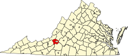
 Location within the Commonwealth of Virginia  Wabun, Virginia (the United States) | |
| Coordinates: 37°14′56″N80°08′29″W / 37.24889°N 80.14139°W | |
| Country | United States |
| State | Virginia |
| County | Roanoke |
| Elevation | 1,099 ft (335 m) |
| Time zone | UTC−5 (Eastern (EST)) |
| • Summer (DST) | UTC−4 (EDT) |
| ZIP code | 24153 |
| Area code | 540 |
| GNIS feature ID | 1494287 [1] |
| USGS [2] | |
Wabun is an unincorporated community in western Roanoke County, Virginia, United States. The community lies along the Roanoke River and near the base of Poor Mountain. [3]