Union Township | |
|---|---|
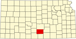
 Location in Kingman County | |
| Coordinates: 37°36′05″N98°18′01″W / 37.60139°N 98.30028°W | |
| Country | United States |
| State | Kansas |
| County | Kingman |
| Area | |
• Total | 36.23 sq mi (93.84 km2) |
| • Land | 36.1 sq mi (93.6 km2) |
| • Water | 0.093 sq mi (0.24 km2) 0.26% |
| Elevation | 1,670 ft (509 m) |
| Population (2000) | |
• Total | 88 |
| • Density | 2.3/sq mi (0.9/km2) |
| GNIS feature ID | 0473956 |
Union Township is a township in Kingman County, Kansas, United States. As of the 2000 census, its population was 88. [1]