Union Center Township | |
|---|---|
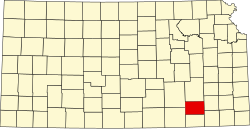
 Location in Elk County | |
| Coordinates: 37°28′00″N096°26′01″W / 37.46667°N 96.43361°W | |
| Country | United States |
| State | Kansas |
| County | Elk |
| Area | |
• Total | 143.99 sq mi (372.92 km2) |
| • Land | 143.33 sq mi (371.22 km2) |
| • Water | 0.66 sq mi (1.7 km2) 0.46% |
| Elevation | 1,414 ft (431 m) |
| Population (2000) | |
• Total | 116 |
| • Density | 0.78/sq mi (0.3/km2) |
| GNIS feature ID | 1729700 |
Union Center Township is a township in Elk County, Kansas, United States. As of the 2000 census, its population was 116.