Taylor | |
|---|---|
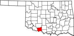
 Taylor Location within the state of Oklahoma  Taylor Taylor (the United States) | |
| Coordinates: 34°10′25″N98°19′52″W / 34.17361°N 98.33111°W | |
| Country | United States |
| State | Oklahoma |
| County | Cotton |
| Elevation | 997 ft (304 m) |
| Time zone | UTC-6 (Central (CST)) |
| • Summer (DST) | UTC-5 (CDT) |
| GNIS feature ID | 1100877 [1] |
Taylor is an unincorporated community in Cotton County, Oklahoma, United States. [1] The elevation is 994 feet. [1] It was named after a local merchant, John Taylor. [2] The community had a post office from November 30, 1907 to May 31, 1911. [2]