Tarico Heights | |
|---|---|
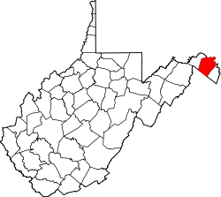
 Tarico Heights Location within the state of West Virginia  Tarico Heights Tarico Heights (the United States) | |
| Coordinates: 39°19′35″N78°00′14″W / 39.32639°N 78.00389°W | |
| Country | United States |
| State | West Virginia |
| County | Berkeley |
| Elevation | 574 ft (175 m) |
| Time zone | UTC-5 (Eastern (EST)) |
| • Summer (DST) | UTC-4 (EDT) |
| GNIS feature ID | 1547905 [1] |
Tarico Heights is an unincorporated community on West Virginia Route 51 along Opequon Creek in Berkeley County, West Virginia, United States.