英文互译镜像站

Soap Creek Township, Davis County, Iowa

Last updated

Soap Creek Township
Map highlighting Soap Creek Township, Davis County, Iowa.svg
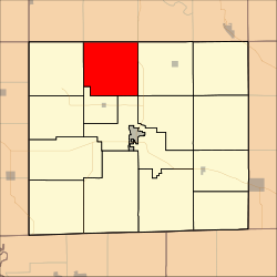
Location in Davis County
Coordinates: 40°51′47″N92°28′11″W / 40.86306°N 92.46972°W / 40.86306; -92.46972
Country Flag of the United States (23px).png  United States
State Flag of Iowa.svg Iowa
County Davis
Area
  Total
34.90 sq mi (90.38 km2)
  Land34.85 sq mi (90.25 km2)
  Water0.050 sq mi (0.13 km2)  0.14%
Elevation
814 ft (248 m)
Population
 (2000)
  Total
610
  Density18/sq mi (6.8/km2)
GNIS feature ID 0468724

Soap Creek Township is a township in Davis County, Iowa, United States. As of the 2000 census, its population was 610.

Contents

History

Soap Creek Township was organized in 1846. [1] It took its name from Soap Creek. [2]

Geography

Soap Creek Township covers an area of 34.9 square miles (90.38 square kilometers); of this, 0.05 square miles (0.13 square kilometers) or 0.14 percent is water. The stream of Bear Creek runs through this township.

Unincorporated towns

(This list is based on USGS data and may include former settlements.)

Adjacent townships

Cemeteries

The township contains eight cemeteries: Baer, Breeding, Harbour, Kingdom, Rime, Roland, Rudd and Sherman Chapel.

Major highways

References

  1. History of Davis County, Iowa. State Historical Company. 1882. pp.  428.
  2. History of Davis County, Iowa: Containing a History of the County, Its Cities, Towns, Etc. State Historical Company. 1882. p.  598.


英文互译镜像站 递归网站下载 网站镜像克隆 镜像程序 蚂蚁超级镜像