英文互译镜像站

Snapfinger, Georgia

Last updated

Snapfinger, Georgia
USA Georgia location map.svg
Red pog.svg
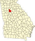
Snapfinger
Location within the state of Georgia
Usa edcp location map.svg
Red pog.svg
Snapfinger
Snapfinger (the United States)
Coordinates: 33°41′13″N84°12′6″W / 33.68694°N 84.20167°W / 33.68694; -84.20167
Country United States
State Georgia
County DeKalb
Elevation
279 ft (85 m)
Time zone UTC-5 (Eastern (EST))
  Summer (DST) UTC-4 (EDT)
GNIS feature ID333078 [1]

Snapfinger is an unincorporated community in DeKalb County, Georgia, United States.

History

A post office called Snapfinger was established in 1881, and remained in operation until 1901. [2] The community takes its name from nearby Snapfinger Creek. [3]

References

  1. "Snapfinger". Geographic Names Information System . United States Geological Survey, United States Department of the Interior.
  2. "Post Offices". Jim Forte Postal History. Retrieved June 10, 2019.
  3. Krakow, Kenneth K. (1975). Georgia Place-Names: Their History and Origins (PDF). Macon, GA: Winship Press. p. 207. ISBN   0-915430-00-2.
镜像程序 站点核心词加权 递归网站下载 整站镜像下载 网站克隆