英文互译镜像站

Siddins Point

Last updated
Location of Livingston Island in the South Shetland Islands. Livingston-Island-location-map.png
Location of Livingston Island in the South Shetland Islands.
Topographic map of Livingston Island. Livingston-Island-Map-2010-15.png
Topographic map of Livingston Island.

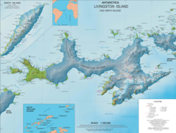
Siddins Point ( 62°32′41.8″S60°26′05″W / 62.544944°S 60.43472°W / -62.544944; -60.43472 ) is a point projecting into the middle of the head of Hero Bay on the north coast of Livingston Island in the South Shetland Islands, Antarctica. Named by the United Kingdom Antarctic Place-Names Committee (UK-APC) in 1958 for Captain Richard Siddins, Master of the Australian sealer Lynx of Sydney, who visited the South Shetland Islands in 1820-21 and 1821–22. Until 2011 the name was incorrectly spelt 'Siddons Point'. [1]

Maps

References

PD-icon.svg This article incorporates public domain material from "Siddins Point". Geographic Names Information System . United States Geological Survey.  OOjs UI icon edit-ltr-progressive.svg


递归网站下载 开源整站镜像工具 泛域名镜像 泛域名镜像 镜像网站程序