Quebrada Arriba | |
|---|---|
Barrio | |
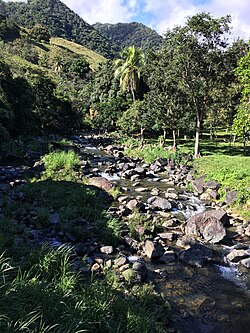
| Recreation area near Quebrada Arriba | |
| Location of Quebrada Arriba within the municipality of Patillas shown in red | |
| Coordinates: 18°02′56″N66°04′15″W / 18.048873°N 66.070868°W [1] | |
| Commonwealth | |
| Municipality | |
| Area | |
• Total | 3.64 sq mi (9.4 km2) |
| • Land | 3.64 sq mi (9.4 km2) |
| • Water | 0 sq mi (0 km2) |
| Elevation | 709 ft (216 m) |
| Population (2010) | |
• Total | 711 |
| • Density | 195.3/sq mi (75.4/km2) |
| Source: 2010 Census | |
| Time zone | UTC−4 (AST) |
| ZIP Code | 00723 |
| Area code | 787/939 |
Quebrada Arriba is a barrio in the municipality of Patillas, Puerto Rico. Its population in 2010 was 711. [3] [4] [5]
Quebrada Arriba was in Spain's gazetteers [6] until Puerto Rico was ceded by Spain in the aftermath of the Spanish–American War under the terms of the Treaty of Paris of 1898 and became an unincorporated territory of the United States. In 1899, the United States Department of War conducted a census of Puerto Rico finding that the combined population of Quebrada Arriba and Cacao Bajo barrios was 928. [7]
| Census | Pop. | Note | %± |
|---|---|---|---|
| 1910 | 609 | — | |
| 1920 | 640 | 5.1% | |
| 1930 | 658 | 2.8% | |
| 1940 | 771 | 17.2% | |
| 1950 | 747 | −3.1% | |
| 1960 | 511 | −31.6% | |
| 1970 | 754 | 47.6% | |
| 1980 | 862 | 14.3% | |
| 1990 | 792 | −8.1% | |
| 2000 | 843 | 6.4% | |
| 2010 | 711 | −15.7% | |
| U.S. Decennial Census 1900 (N/A) [8] 1910-1930 [9] 1930-1950 [10] 1980-2000 [11] 2010 [12] | |||
Barrios (which are, in contemporary times, roughly comparable to minor civil divisions) [13] in turn are further subdivided into smaller local populated place areas/units called sectores (sectors in English). The types of sectores may vary, from normally sector to urbanización to reparto to barriada to residencial, among others. [14] [15] [16]
The following sectors are in Quebrada Arriba barrio: [17]
Carretera 184, Carretera 762, Sector Fondo del Saco, Sector Las Parcelas, and Sector Los Cafeítos.