Pissy | |
|---|---|
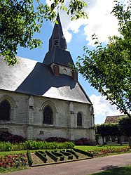 The church in Pissy | |
 Coat of arms | |
Location of Pissy  | |
 Pissy  Pissy | |
| Coordinates: 49°51′46″N2°07′54″E / 49.8628°N 2.1317°E | |
| Country | France |
| Region | Hauts-de-France |
| Department | Somme |
| Arrondissement | Amiens |
| Canton | Ailly-sur-Somme |
| Intercommunality | Amiens Métropole |
| Government | |
| • Mayor (2020–2026) | Laurent Vindevogel [1] |
Area 1 | 6.63 km2 (2.56 sq mi) |
| Population (2022) [2] | 290 |
| • Density | 44/km2 (110/sq mi) |
| Time zone | UTC+01:00 (CET) |
| • Summer (DST) | UTC+02:00 (CEST) |
| INSEE/Postal code | 80626 /80540 |
| Elevation | 90–127 m (295–417 ft) (avg. 112 m or 367 ft) |
| 1 French Land Register data, which excludes lakes, ponds, glaciers > 1 km2 (0.386 sq mi or 247 acres) and river estuaries. | |
Pissy (French pronunciation: [pisi] ) is a commune in the Somme department in Hauts-de-France in northern France.