Milburn, Texas | |
|---|---|
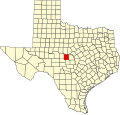
 Milburn, Texas Location within the state of Texas  Milburn, Texas Milburn, Texas (the United States) | |
| Coordinates: 31°26′16″N99°06′35″W / 31.43778°N 99.10972°W | |
| Country | United States |
| State | Texas |
| County | McCulloch |
| Elevation | 1,312 ft (400 m) |
| Time zone | UTC-6 (Central (CST)) |
| • Summer (DST) | UTC-5 (CDT) |
| ZIP code | 76825 |
| Area code | 325 |
| GNIS feature ID | 1380197 [1] |
Milburn is an unincorporated farming and ranching community established in 1873 in the county of McCulloch, in the U.S. state of Texas. [2] It is the birthplace of the former boxer Lew Jenkins.