Madonnaville, Illinois | |
|---|---|
 Madonnaville  Madonnaville | |
| Coordinates: 38°15′54″N90°14′48″W / 38.26500°N 90.24667°W | |
| Country | United States |
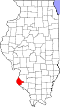
| State | Illinois |
| County | Monroe |
| Precinct | 23 |
| Elevation | 732 ft (223 m) |
| Time zone | UTC-6 (CST) |
| • Summer (DST) | UTC-5 (CDT) |
| Postal code | 62298 |
| Area code | 618 |
Madonnaville, Illinois is a small unincorporated community in the historic Bluff Precinct of Monroe County, Illinois, United States. It was laid out by Joseph W. Ruebsam, who erected the first building and started a store there shortly thereafter. St. Mary's Catholic Church was built in 1857. [1]