Lund, Wisconsin | |
|---|---|
 Lund, Wisconsin  Lund, Wisconsin | |
| Coordinates: 44°32′23″N92°12′22″W / 44.53972°N 92.20611°W | |
| Country | |
| State | |
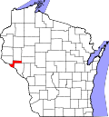
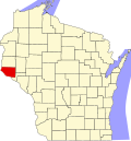
| County | Pepin, Pierce |
| Elevation | 1,138 ft (347 m) |
| Time zone | UTC-6 (Central (CST)) |
| • Summer (DST) | UTC-5 (CDT) |
| Area codes | 715 & 534 |
| GNIS feature ID | 1568805 [1] |
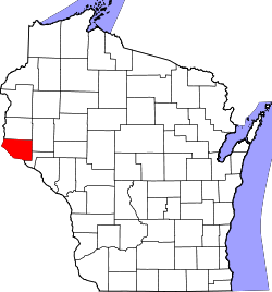
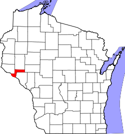
Lund is an unincorporated community located in two counties of the U.S. state of Wisconsin. The community lies on the county line between Pepin County, in the town of Pepin, and Pierce County, in the town of Maiden Rock, in central western Wisconsin, along the junctions of County Trunk Highway SS (CTH-SS), CTH-CC(formerly WIS 183), and CTH-J. Lund is approximately nine miles northwest of Pepin and six miles northeast of Stockholm, Wisconsin. [1] [2]