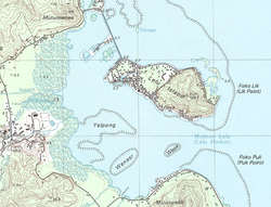
 Topographic map of Lelu Island | |
 Interactive map of Lelu | |
| Geography | |
|---|---|
| Location | North Pacific |
| Coordinates | 5°20′N163°02′E / 5.333°N 163.033°E |
| Archipelago | Caroline |
| Total islands | 1 |
| Area | 1 km2 (0.39 sq mi) |
| Highest elevation | 109.7 m (359.9 ft) |
| Administration | |
| Demographics | |
| Population | 1,594 (1980) |
| Ethnic groups | Micronesian (Kosraean) |

Lelu Island is a small island in Lelu Harbour, in the Lelu municipality of Kosrae. It is home to the Leluh archaeological site.