英文互译镜像站

Lancaster Township, Jefferson County, Indiana

Last updated

Lancaster Township
Map highlighting Lancaster Township, Jefferson County, Indiana.svg
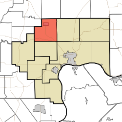
Location in Jefferson County
Coordinates: 38°52′07″N85°30′28″W / 38.86861°N 85.50778°W / 38.86861; -85.50778
Country United States
State Indiana
County Jefferson
Government
  Type Indiana township
Area
  Total
32.23 sq mi (83.5 km2)
  Land32.18 sq mi (83.3 km2)
  Water0.05 sq mi (0.13 km2)  0.16%
Elevation
794 ft (242 m)
Population
 (2020)
  Total
1,494
  Density46.43/sq mi (17.93/km2)
GNIS feature ID0453539

Lancaster Township is one of ten townships in Jefferson County, Indiana, United States. As of the 2020 census, its population was 1,494 (down from 1,511 at 2010 [1] ) and it contained 610 housing units. [2]

Contents

Historical population
CensusPop.Note
1890 1,272
1900 1,2790.6%
1910 1,229−3.9%
1920 1,160−5.6%
1930 953−17.8%
1940 9863.5%
1950 1,12414.0%
1960 1,2309.4%
1970 1,3459.3%
1980 1,48410.3%
1990 1,5343.4%
2000 1,6084.8%
2010 1,511−6.0%
2020 1,494−1.1%
Source: US Decennial Census [3]

History

Eleutherian College and the Lyman and Asenath Hoyt House are listed on the National Register of Historic Places. [4]

Geography

According to the 2010 census, the township has a total area of 32.23 square miles (83.5 km2), of which 32.18 square miles (83.3 km2) (or 99.84%) is land and 0.05 square miles (0.13 km2) (or 0.16%) is water. [1] The streams of Middle Fork Creek and Turkey Branch run through this township.

Cities and towns

Unincorporated towns

Extinct towns

Adjacent townships

Cemeteries

The township contains five cemeteries: Bland, Clashman, College Hill, Nelson and Ogden.

Major highways

Education

It is in the Madison Consolidated Schools school district. [5]

The zoned MCS elementary school for part of the township is Anderson Elementary School, while another part is zoned to Deputy Elementary School. [6] The zoned secondary schools of the Madison district are Madison Junior High School and Madison Consolidated High School.

References

  1. 1 2 "Population, Housing Units, Area, and Density: 2010 - County -- County Subdivision and Place -- 2010 Census Summary File 1". United States Census. Archived from the original on February 12, 2020. Retrieved May 10, 2013.
  2. "Explore Census Data". data.census.gov. Retrieved April 10, 2024.
  3. "Township Census Counts: STATS Indiana".
  4. "National Register Information System". National Register of Historic Places . National Park Service. July 9, 2010.
  5. Geography Division (December 18, 2020). 2020 Census - School District Reference Map: Jefferson County, IN (PDF) (Map). Suitland, Maryland: U.S. Census Bureau . Retrieved February 7, 2026. - Text list
  6. "Elementary School District Map". Madison Consolidated Schools . Retrieved February 7, 2026.
MirrorElf 伪原创镜像站 站群克隆软件 霸屏SEO镜像站群 百变TDK镜像