英文互译镜像站

Irene, South Dakota

Last updated

Irene, South Dakota
Clay County South Dakota Incorporated and Unincorporated areas Irene Highlighted.svg
Location in Clay County and the state of South Dakota
Coordinates: 43°05′01″N97°09′27″W / 43.08361°N 97.15750°W / 43.08361; -97.15750
Country United States
State South Dakota
Counties Turner, Clay, Yankton
Incorporated1895 [1]
Area
[2]
  Total
0.25 sq mi (0.66 km2)
  Land0.25 sq mi (0.66 km2)
  Water0 sq mi (0.00 km2)
Elevation
[3]
1,394 ft (425 m)
Population
 (2020) [4]
  Total
422
  Density1,653.2/sq mi (638.32/km2)
Time zone UTC-6 (Central (CST))
  Summer (DST) UTC-5 (CDT)
ZIP code
57037
Area code 605
FIPS code 46-31940 [5]
GNIS feature ID1267437 [3]
Website www.irenesd.com

Irene is a city in Clay, Turner, and Yankton counties in South Dakota, United States. The population was 422 at the 2020 census. [6] The portion of Irene that is located in Turner County is a part of the Sioux Falls, South Dakota metropolitan area, the portion located in Yankton County is part of the Yankton Micropolitan Statistical Area, and the portion located in Clay County is part of both the Vermillion Micropolitan Statistical Area and the Sioux City-Vermillion Combined Statistical Area. Irene is also host to the Irene Rodeo, held every summer.

Contents

Irene was laid out in 1893, and named after Irene Fry, the daughter of a first settler. [7]

Geography

According to the United States Census Bureau, the city has a total area of 0.26 square miles (0.67 km2), all land. [8]

South Dakota Highway 46 runs east–west through the city. Irene is located approximately 18 miles west of I-29.

Demographics

Historical population
CensusPop.Note
1900 229
1910 26314.8%
1920 44669.6%
1930 49110.1%
1940 391−20.4%
1950 374−4.3%
1960 3996.7%
1970 46115.5%
1980 52313.4%
1990 464−11.3%
2000 432−6.9%
2010 420−2.8%
2020 4220.5%
U.S. Decennial Census [9] [4]

2020 census

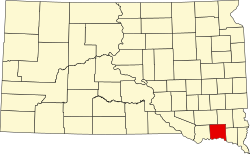
As of the 2020 census, Irene had a population of 422. The median age was 42.5 years. 23.9% of residents were under the age of 18 and 22.0% of residents were 65 years of age or older. For every 100 females there were 114.2 males, and for every 100 females age 18 and over there were 114.0 males age 18 and over. [10] [11]

0.0% of residents lived in urban areas, while 100.0% lived in rural areas. [12]

There were 166 households in Irene, of which 29.5% had children under the age of 18 living in them. Of all households, 41.0% were married-couple households, 24.7% were households with a male householder and no spouse or partner present, and 25.3% were households with a female householder and no spouse or partner present. About 38.6% of all households were made up of individuals and 14.4% had someone living alone who was 65 years of age or older. [10]

There were 190 housing units, of which 12.6% were vacant. The homeowner vacancy rate was 1.7% and the rental vacancy rate was 10.0%. [10]

Racial composition as of the 2020 census [11]
RaceNumberPercent
White 39493.4%
Black or African American 00.0%
American Indian and Alaska Native 122.8%
Asian 20.5%
Native Hawaiian and Other Pacific Islander 00.0%
Some other race81.9%
Two or more races 61.4%
Hispanic or Latino (of any race)112.6%

2010 census

As of the census [13] of 2010, there were 420 people, 172 households, and 102 families residing in the city. The population density was 1,615.4 inhabitants per square mile (623.7/km2). There were 194 housing units at an average density of 746.2 per square mile (288.1/km2). The racial makeup of the city was 98.6% White, 0.7% Native American, 0.2% Asian, 0.2% from other races, and 0.2% from two or more races. Hispanic or Latino of any race were 0.5% of the population.

There were 172 households, of which 29.7% had children under the age of 18 living with them, 44.2% were married couples living together, 9.9% had a female householder with no husband present, 5.2% had a male householder with no wife present, and 40.7% were non-families. 35.5% of all households were made up of individuals, and 15.7% had someone living alone who was 65 years of age or older. The average household size was 2.18 and the average family size was 2.78.

The median age in the city was 43.1 years. 22.6% of residents were under the age of 18; 5% were between the ages of 18 and 24; 25.2% were from 25 to 44; 26.4% were from 45 to 64; and 20.7% were 65 years of age or older. The gender makeup of the city was 44.0% male and 56.0% female.

2000 census

As of the census [5] of 2000, there were 432 people, 169 households, and 110 families residing in the city. The population density was 1,790.0 inhabitants per square mile (691.1/km2). There were 189 housing units at an average density of 783.1 per square mile (302.4/km2). The racial makeup of the city was 99.77% White and 0.23% Native American.

There were 169 households, out of which 26.0% had children under the age of 18 living with them, 56.8% were married couples living together, 7.1% had a female householder with no husband present, and 34.9% were non-families. 32.5% of all households were made up of individuals, and 19.5% had someone living alone who was 65 years of age or older. The average household size was 2.21 and the average family size was 2.76.

In the city, the population was spread out, with 19.7% under the age of 18, 6.9% from 18 to 24, 20.1% from 25 to 44, 22.0% from 45 to 64, and 31.3% who were 65 years of age or older. The median age was 47 years. For every 100 females, there were 79.3 males. For every 100 females age 18 and over, there were 70.9 males.

The median income for a household in the city was $30,500, and the median income for a family was $39,688. Males had a median income of $29,583 versus $20,000 for females. The per capita income for the city was $14,983. About 4.7% of families and 9.0% of the population were below the poverty line, including 10.8% of those under age 18 and 11.8% of those age 65 or over.

Education

The school district is Irene-Wakonda School District 13-3. [14] [15] [16]

See also

References

  1. "SD Towns" (PDF). South Dakota State Historical Society. Archived from the original (PDF) on February 10, 2010. Retrieved February 13, 2010.
  2. "ArcGIS REST Services Directory". United States Census Bureau. Retrieved October 15, 2022.
  3. 1 2 U.S. Geological Survey Geographic Names Information System: Irene, South Dakota
  4. 1 2 "Census Population API". United States Census Bureau. Retrieved October 15, 2022.
  5. 1 2 "U.S. Census website". United States Census Bureau . Retrieved January 31, 2008.
  6. "U.S. Census Bureau: Irene city, South Dakota". www.census.gov. United States Census Bureau. Retrieved March 11, 2022.
  7. Federal Writers' Project (1940). South Dakota place-names, v.1-3. University of South Dakota. p. 43.
  8. "US Gazetteer files 2010". United States Census Bureau. Archived from the original on July 2, 2012. Retrieved June 21, 2012.
  9. "Census of Population and Housing". Census.gov. Retrieved June 4, 2015.
  10. 1 2 3 "2020 Decennial Census Demographic Profile (DP1)". United States Census Bureau. 2021. Retrieved February 5, 2026.
  11. 1 2 "2020 Decennial Census Redistricting Data (Public Law 94-171)". United States Census Bureau. 2021. Retrieved February 5, 2026.
  12. "2020 Decennial Census Demographic and Housing Characteristics (DHC)". United States Census Bureau. 2023. Retrieved February 5, 2026.
  13. "U.S. Census website". United States Census Bureau . Retrieved June 21, 2012.
  14. Geography Division (January 14, 2021). 2020 Census - School District Reference Map: Clay County, SD (PDF) (Map). Suitland, Maryland: U.S. Census Bureau . Retrieved January 24, 2026. - Text list
  15. Geography Division (January 14, 2021). 2020 Census - School District Reference Map: Turner County, SD (PDF) (Map). Suitland, Maryland: United States Census Bureau . Retrieved January 24, 2026. - Text list
  16. Geography Division (January 14, 2021). 2020 Census - School District Reference Map: Yankton County, SD (PDF) (Map). Suitland, Maryland: U.S. Census Bureau . Retrieved January 24, 2026. - Text list
站点克隆软件 镜像网站程序 一键镜像站群 一键镜像站群 英文互译镜像站