Hummel | |
|---|---|
 Hummel  Hummel | |
| Coordinates: 37°23′47″N84°17′07″W / 37.39639°N 84.28528°W | |
| Country | United States |
| State | Kentucky |
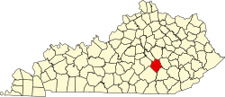
| County | Rockcastle |
| Elevation | 1,056 ft (322 m) |
| Time zone | UTC-5 (Eastern (EST)) |
| • Summer (DST) | UTC-4 (EDT) |
| ZIP code | 38530 |
| Area code | 606 |
| GNIS feature ID | 512847 [1] |
Hummel (often pronounced Humble) is an unincorporated community in Rockcastle County, Kentucky, United States. [1] The community is accessed from Kentucky Route 1786 (Wildie Road) or U.S. Route 25 via Hummel Road.