Hale, Colorado | |
|---|---|
 County Road LL.5 in Hale, looking north (2017) | |
 Hale  Hale | |
| Coordinates: 39°37′46.98″N102°8′33.68″W / 39.6297167°N 102.1426889°W [1] | |
| Country | United States |
| State | Colorado |
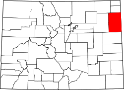
| Counties | Yuma [2] |
| Elevation | 3,606 ft (1,099 m) |
| Time zone | UTC−7 (MST) |
| • Summer (DST) | UTC−6 (MDT) |
| ZIP Code | |
| Area code | 970 |
| FIPS code | 08-33805 [1] |
| GNIS ID | 195046 [1] |
Hale is an Unincorporated community in Yuma County, Colorado, United States. [1] It is located along US 36.