Hafning bei Trofaiach | |
|---|---|
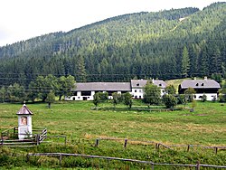 Rötzhube (part of Hafning bei Trofaiach) | |
 Coat of arms | |
 Hafning bei Trofaiach Location within Austria | |
| Coordinates: 47°26′39″N14°59′55″E / 47.44417°N 14.99861°E | |
| Country | Austria |
| State | Styria |
| District | Leoben |
| Area | |
• Total | 76.34 km2 (29.48 sq mi) |
| Elevation | 685 m (2,247 ft) |
| Population (2007-01-01) | |
• Total | 1,647 |
| • Density | 22/km2 (56/sq mi) |
| Time zone | UTC+1 (CET) |
| • Summer (DST) | UTC+2 (CEST) |
| Postal code | 8793 and 8794 |
| Area code | 03847 |
| Vehicle registration | LN |
| Website | www.data-matic.at/hafning |
Hafning bei Trofaiach is a village and a former municipality in the district of Leoben in Styria, Austria. Since January 2013, it is part of the town Trofaiach.