Greendale, Illinois | |
|---|---|
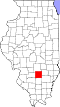
 Greendale  Greendale | |
| Coordinates: 38°37′47″N88°41′52″W / 38.62972°N 88.69778°W | |
| Country | United States |
| State | Illinois |
| Counties | Clay, Marion |
| Elevation | 522 ft (159 m) |
| Time zone | UTC-6 (Central (CST)) |
| • Summer (DST) | UTC-5 (CDT) |
| Area code | 618 |
| GNIS feature ID | 422755 [1] |
Greendale is an unincorporated community in Clay and Marion counties, Illinois, United States. Greendale is located on U.S. Route 50 west of Xenia and east of Iuka.