Garfield Township | |
|---|---|
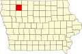
 Location in Clay County | |
| Coordinates: 42°56′46″N094°59′00″W / 42.94611°N 94.98333°W | |
| Country | |
| State | |
| County | Clay |
| Area | |
• Total | 36.0 sq mi (93.2 km2) |
| • Land | 35.96 sq mi (93.14 km2) |
| • Water | 0.023 sq mi (0.06 km2) 0.06% |
| Elevation | 1,410 ft (430 m) |
| Population (2000) | |
• Total | 311 |
| • Density | 8.5/sq mi (3.3/km2) |
| GNIS feature ID | 0467891 |
Garfield Township is a township in Clay County, Iowa, United States. As of the 2000 census, its population was 311.