Frank, West Virginia | |
|---|---|
Census-designated place (CDP) | |
 Nazarene church | |
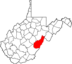
 Frank, West Virginia Location within the state of West Virginia | |
| Coordinates: 38°32′54″N79°48′20″W / 38.54833°N 79.80556°W | |
| Country | United States |
| State | West Virginia |
| County | Pocahontas |
| Area | |
• Total | 0.383 sq mi (0.99 km2) |
| • Land | 0.383 sq mi (0.99 km2) |
| • Water | 0 sq mi (0 km2) |
| Population (2020) | |
• Total | 79 |
| • Density | 210/sq mi (80/km2) |
| Time zone | UTC-5 (Eastern (EST)) |
| • Summer (DST) | UTC-4 (EDT) |
Frank is a census-designated place (CDP) in Pocahontas County, West Virginia, United States. The population was 79 at the 2020 census (down from 90 at the 2010 census). [2] [3] It was named to honor Frank Hoffman in 1926. Hoffman was the proprietor of a local tannery. [4]
The unemployment rate in Frank is 6.2% (U.S. avg. is 3.9%). Compared to the rest of the country, Frank's cost of living is 28.8% lower than the U.S. average.