This article needs additional citations for verification .(March 2007) |
Curtis Park | |
|---|---|
 | |
 Curtis Park Location within Sacramento | |
| Coordinates: 38°32′44″N121°28′45″W / 38.54548°N 121.47922°W | |
| Country | United States |
| State | California |
| County | Sacramento |
| City | Sacramento |
| ZIP Code | 95818 |
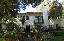
Curtis Park is a neighborhood located within the city of Sacramento, California. Curtis Park is defined as north of Sutterville Road, south of Broadway, east of Freeport Boulevard, and west of Highway 99. Curtis Park is a largely residential neighborhood. It is known for its charming vintage homes including Victorian, Bungalow, and 1920s revival style subdivisions. Information about the neighborhood can be obtained from the Sierra Curtis Neighborhood Association.
