Corinth Township | |
|---|---|
 Farmland in Corinth Township | |
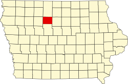
 Location in Humboldt County | |
 Humboldt County's location in Iowa | |
| Coordinates: 42°41′N94°16′W / 42.683°N 94.267°W | |
| Country | |
| State | |
| County | Humboldt |
| Established | 1876 |
| Area | |
• Total | 32.8 sq mi (85 km2) |
| • Land | 32.7 sq mi (85 km2) |
| • Water | 0.1 sq mi (0.26 km2) |
| Elevation | 1,129 ft (344 m) |
| Population (2000) | |
• Total | 366 |
| • Density | 11/sq mi (4.2/km2) |
| Time zone | UTC-6 (CST) |
| • Summer (DST) | UTC-5 (CDT) |
| ZIP codes | 50548 (Humboldt) |
| GNIS feature ID | 0467658 |
| U.S. Geological Survey Geographic Names Information System: Corinth Township, Humboldt County, Iowa | |
Corinth Township is one of twelve townships in Humboldt County, Iowa, United States. [1] As of the 2000 census, its unincorporated population was 366. Corinth Township also contains most of the largest town in Humboldt County, Humboldt.
