Carrollton Township | |
|---|---|
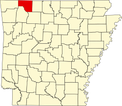
 Carrollton Township Location in Arkansas | |
| Coordinates: 36°14′38.32″N93°20′23.99″W / 36.2439778°N 93.3399972°W | |
| Country | |
| State | |
| County | Carroll |
| Area | |
• Total | 35.742 sq mi (92.57 km2) |
| • Land | 35.734 sq mi (92.55 km2) |
| • Water | 0.008 sq mi (0.021 km2) |
| Elevation | 1,224 ft (373 m) |
| Population (2010) | |
• Total | 716 |
| • Density | 20.04/sq mi (7.74/km2) |
| Time zone | UTC-6 (CST) |
| • Summer (DST) | UTC-5 (CDT) |
| Zip Code | 72611 (Alpena) |
| Area code | 870 |
| GNIS feature ID | 66891 [1] |
Carrollton Township is one of twenty-one current townships in Carroll County, Arkansas, USA. [2] As of the 2010 census, its total population was 716.
Contents
Carrollton Township was formed prior to 1870; the exact date is unknown since county records were lost. [3]