Calumet, Arkansas | |
|---|---|
 Calumet  Calumet | |
| Coordinates: 35°58′54″N89°59′10″W / 35.98167°N 89.98611°W | |
| Country | United States |
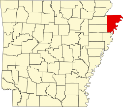
| State | Arkansas |
| County | Mississippi |
| Elevation | 246 ft (75 m) |
| Time zone | UTC-6 (Central (CST)) |
| • Summer (DST) | UTC-5 (CDT) |
| Area code | 870 |
| GNIS feature ID | 56948 [1] |
Calumet is an unincorporated community in Mississippi County, Arkansas, United States. Calumet is located at the junction of Arkansas highways 151 and 181 on the northeast border of Gosnell. [2]