Aydelotte | |
|---|---|
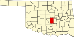
 Aydelotte Location within the state of Oklahoma  Aydelotte Aydelotte (the United States) | |
| Coordinates: 35°26′39″N96°54′42″W / 35.44417°N 96.91167°W | |
| Country | United States |
| State | Oklahoma |
| County | Pottawatomie |
| Elevation | 991 ft (302 m) |
| Time zone | UTC-6 (Central (CST)) |
| • Summer (DST) | UTC-5 (CDT) |
| GNIS feature ID | 1089773 [1] |
Aydelotte is a community located in Pottawatomie County, Oklahoma, United States. It is north of Shawnee and just south of Meeker along Oklahoma State Highway 18. [2] The town as platted by the Santa Fe Railroad in 1903 was called Hansmeyer, but became Aydelotte for one of the railroad employees, J.M. Aydelotte.