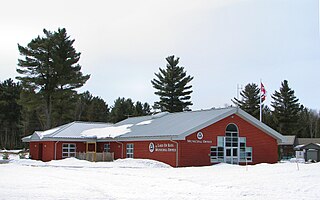
The Limberlost Forest and Wildlife Reserve is a publicly accessible private property near Huntsville, Ontario, Canada. The private forest contains many lakes and forest stands with hiking, biking, skiing and snowshoeing trails throughout that has been made available to the public at no charge. Limberlost practices a form of land management referred to as Conscientious Forest Management which focuses on ensuring the sustainability of their management objectives and actions for generations to come. Some of the management actions undertaken by the private forest include sustainably harvesting timber using the Ontario Ministry of Natural ResourcesSingle Tree Selection System; encouraging the use of the forest by all visitors and eco-tourists at no charge; supporting environmental research programs and institutes; and offering both modern and traditional forest land use options to the local community.
Huntsville is the largest town in the Muskoka Region of Ontario, Canada. It is located 215 kilometres (134 mi) north of Toronto and 130 kilometres (81 mi) south of North Bay.
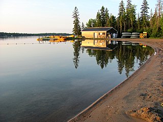
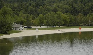
Limberlost's primary objective is to offer continued free access to the 10,000 ac Muskoka property for the purpose of encouraging safe wilderness experiences. They are able to accomplish this by supporting several youth organizations, such as the Trails Youth Initiative, as well as providing hiking trails, associated maps and safety information to day visitors. Free use of the property is made possible by the accommodations business which is run in conjunction with Limberlost including rental of chalets, cottages, fish-camps, glamping sites and camp sites.
Peter Dalglish, is a Canadian humanitarian and founder of the Street Kids International charity. Until 2015 he was the Country Representative for UN-Habitat in Afghanistan.
Glamping is a portmanteau of glamorous and camping and describes a style of camping with amenities and, in some cases, resort-style services not usually associated with "traditional" camping. Glamping has become particularly popular with 21st-century tourists seeking the luxuries of hotel accommodation alongside "the escapism and adventure recreation of camping".
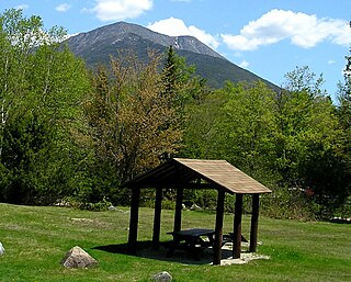
The trails at the Limberlost Forest provide access to innumerable special natural features as well as tours around a number of the larger lakes. Guests are encouraged to familiarize themselves with trail guide and safety information before embarking on their day tour.
Access of the Limberlost Forest is available at the main gate located 3 km off of Muskoka Road 8 in Lake of Bays. Limberlost does not permit the recreational use of snowmobiles, ATVs, UTVs, or any gas powered motor boats, however, bicycles, paddles, hiking boots, and snowshoes are welcome and encouraged.
Lake of Bays is a township within the District Municipality of Muskoka, Ontario, Canada. The township, situated 193 kilometres (120 mi) north of Toronto, is named after the Lake of Bays.
Since 2003, the Limberlost Reserve has been open to the public, receiving several thousand visitors per year mainly for hiking and bird-watching.
This page is based on this Wikipedia article Text is available under the CC BY-SA 4.0 license; additional terms may apply. Images, videos and audio are available under their respective licenses.
Related Research Articles
Algonquin Provincial Park is a provincial park located between Georgian Bay and the Ottawa River in Ontario, Canada, mostly within the Unorganized South Part of Nipissing District. Established in 1893, it is the oldest provincial park in Canada. Additions since its creation have increased the park to its current size of about 7,653 square kilometres (2,955 sq mi). For comparison purposes, this is about one and a half times the size of Prince Edward Island or about a quarter of the size of Belgium. The park is contiguous with several smaller, administratively separate provincial parks that protect important rivers in the area, resulting in a larger total protected area.
Lake Superior Provincial Park is one of the largest provincial parks in Ontario, covering about 1,550 square kilometres (600 sq mi) along the northeastern shores of Lake Superior between Sault Ste. Marie in Algoma District, and Wawa in Northeastern Ontario, Canada. Ontario Highway 17 now runs through the park. When the park was established by Ontario in 1944, there was no road access.
Royal Botanical Gardens (RBG) is headquartered in Burlington and also owns extensive natural areas and gardens lands in Hamilton, Ontario, Canada. It is one of the major tourist attractions between Niagara Falls and Toronto, as well as a significant local and regional horticultural, education, conservation, and scientific resource. On 31 July 2006, Royal Botanical Gardens was selected as the National Focal Point for the Global strategy for plant conservation (GSPC) by Environment Canada.
Baxter State Park is a large wilderness area permanently preserved as a state park, located in Northeast Piscataquis, Piscataquis County in north-central Maine, United States. It is in the North Maine Woods region, and the Katahdin Woods and Waters National Monument borders Baxter State Park.
Tettegouche State Park, in the United States, is a Minnesota state park on the north shore of Lake Superior 58 miles (93 km) northeast of Duluth in Lake County on scenic Minnesota Highway 61. The park's name stems from the Tettegouche Club, an association of local businessmen which purchased the park in 1910 from the Alger-Smith Lumber Company. The club's members protected the area until its sale in 1971 to the deLaittres family. In 1979, the state of Minnesota acquired 3,400 acres (1,400 ha) from the Nature Conservancy, including Tettegouche Camp. The land was added to Baptism River State Park, which was renamed Tettegouche State Park.
Whiteshell Provincial Park is a 2,721 km2 park centrally located in Canada in the province of Manitoba. It is found in the southeast region of the province along the Manitoba-Ontario boundary, approximately 130 km east of the city of Winnipeg. The park is located in the Canadian Shield region and has many rivers, remote lakes, boreal forest and bare granite ridges. It has rare archeological sites of petroforms on flat granite ridges. The park is used year-round for nature-oriented recreation activities.
Three Rivers Park District is a special park district serving the suburban areas of the Twin Cities including suburban Hennepin, Carver, Dakota, Scott and Ramsey counties. Three Rivers's mission is "To promote environmental stewardship through recreation and education in a natural resources-based park system." Three Rivers operates twenty parks and ten regional trails, with at least two more regional trails planned. Nearly seven million people visit Three Rivers facilities each year.
Lake Bemidji State Park is a state park of Minnesota, United States, on the north shore of 6,765-acre (27.38 km2) Lake Bemidji. The northern half of the park preserves a spruce-tamarack bog. A district of National Park Service rustic structures built by the Civilian Conservation Corps and National Youth Administration in the 1930s is on the National Register of Historic Places. The park is located 5 miles (8.0 km) north of the city of Bemidji.
The Sam Houston National Forest, one of four National Forests in Texas, is located 50 miles north of Houston. The forest is administered together with the other three United States National Forests and two National Grasslands located entirely in Texas, from common offices in Lufkin, Texas. The units include Angelina, Davy Crockett, Sabine, and Sam Houston National Forests, plus Caddo National Grassland and Lyndon B. Johnson National Grassland. There are local ranger district offices located in New Waverly.
The Rydell National Wildlife Refuge is an 2,120-acre (9 km2) National Wildlife Refuge in northwestern Minnesota, located in Woodside Township, Polk County, just west of Erskine in northwestern Minnesota. It was established in 1992, and receives more than 7,800 visitors each year. The refuge is a combination of maple/basswood/oak forest, wetlands, tallgrass prairie and bogs.
The High Peaks Wilderness Area, the largest Forest Preserve unit in the U.S. state of New York, is located in three counties and six towns in the Adirondack Park: Harrietstown in Franklin County, North Elba, Keene, North Hudson and Newcomb in Essex County and Long Lake in Hamilton County.
Cheyenne Mountain State Park is a Colorado state park that was acquired in June 2000 through a partnership between the City of Colorado Springs, Colorado State Parks, Great Outdoors Colorado (GOCO), Colorado Lottery, El Paso County, and other local private organizations.
Balsam Lake Provincial Park is a provincial park located in south-central Ontario on Balsam Lake. The park is situated along the Trent-Severn Waterway, a few kilometres southwest of Coboconk. It is an all-seasons recreation area offering camping, boating and fishing, and while closed in winter it is also used for skiing and snowshoeing.
Teatown Lake Reservation is a nonprofit nature preserve and environmental education center in Westchester County, New York, in the United States. The reservation includes an 1,000-acre (4.0 km2) nature preserve and education center located in the Westchester towns of Yorktown, Cortlandt, and New Castle. About 25,000 people come each year to hike the preserve's 15 miles (24 km) of trails, attend an education program, visit the Nature Center, or tour "Wildflower Island". Teatown's educators offer adult, family and children's programs to 20,000 participants annually, including nearly 6,000 schoolchildren and 700 summer camp students.
The Mead Wildlife Area is a state wildlife area covering over 33,000 acres (130 km2) in central Wisconsin. It includes portions of Marathon, Portage, and Wood counties. It is managed by the Wisconsin Department of Natural Resources (WDNR). The Area is commonly referred to as "the Mead". Eight WDNR staff manage the Area. The non-profit organization Friends of the Mead/McMillan Association, Inc. assist with raising funds to support the area's activities.
Papineau-Labelle Wildlife Reserve is a reserve in the Laurentian Mountains of Quebec, Canada, stretching across the Laurentides and Outaouais regions.
Hartman Reserve Nature Center is a 308.9-acre (1.250 km2) nature reserve located in Cedar Falls, Iowa. The reserve is dedicated to teaching youth about nature through hands on experiences and preservation. It is the largest undisturbed wooded area in Black Hawk County, Iowa and is home to three distinct habitats including wetland, forest, and prairie.
Geneva State Forest is an Alabama state forest in Geneva County, Alabama in the United States. The forest is 7,120 acres (2,880 ha) and sits at an elevation of 210 feet (64 m). It is Alabama's largest state forest. According to the Alabama Forestry Commission the primary objective of the state forest is to provide timber for the lumber industry and the secondary objectives are to provide habitats for wildlife and recreational opportunities for people. The forest is open for year-round recreation including hunting, fishing, hiking and camping.
Mount Seymour Provincial Park is a park in Vancouver, British Columbia's North Shore Mountains. With an area of 35 square kilometres, it is located approximately 15 kilometres north of Downtown Vancouver. The park, named after Frederick Seymour, was established in 1936. Mount Seymour Provincial Park provides visitors with a variety of recreational activities and animals with natural habitat.
Mount Sunapee State Park is a state park in Newbury, New Hampshire. The park includes a beach portion on Lake Sunapee and most of Mount Sunapee. The state has leased the ski area to Mount Sunapee Resort.